North Bali Airport Developed Correctly
Public Works Minister Inspects North Bali Airport Site: Avoid Scenario Where Airport Is Built, But Access Roads Are Missing
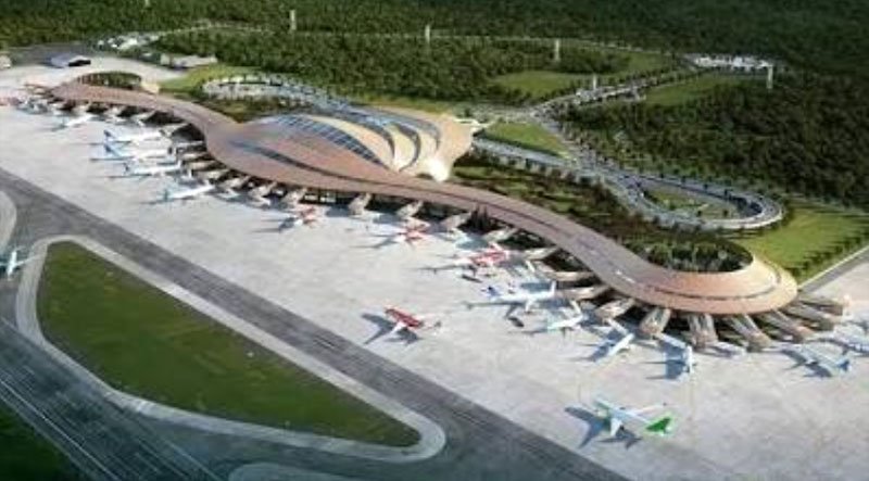
KOMPAS reports that Dody Hanggodo, Indonesia’s Minister of Public Works (PU), has personally inspected the planned site for the North Bali International Airport (BIBU) on Sunday, 27 September 2026. This visit was undertaken to ensure the readiness and suitability of the site and the planned road network serving as supporting infrastructure for access to and from the proposed aerodrome.
Dody stated that his visit to Bali is intended to closely examine the area’s mapping and the supporting road network. This, he said, is crucial to prevent the airport from being developed in an isolated area that is not connected to the rest of Bali by an adequate road network. “We are conducting a site visit to review the concept and the location itself. Relevant parties must coordinate and align their efforts. We must avoid a situation where the airport is completed, yet the supporting access roads are not yet ready,” Dody told Kompas on Saturday, 26 September 2026.
Dody also took the opportunity to comment on the importance of connectivity between North Bali and South Bali to ensure a balanced distribution of goods and tourist mobility. Infrastructure development in North Bali will help alleviate traffic congestion and more equitably disperse economic activity on the Island, which has historically been concentrated in the southern region.
To support the North Bali International Airport, the Ministry of Public Works continues to evaluate options to expand the road network, including improving national roads and constructing toll road sections. “If North Bali is developed effectively, the distribution of tourists will not be concentrated solely in the south. Regarding access, we are evaluating whether to use widened national roads or a toll road; it all depends on requirements and the terrain’s characteristics,” explained the Minister of Public Works.
Hanggodo added that the planned North Bali International Airport is intended not only to handle standard commercial flights but also to serve as key supporting infrastructure for the new Indonesian International Financial Center (IIFC). Regarding funding and investment, the government is open to partnerships with various parties.
While investment financing options are being finalized, the government is ensuring that spatial planning and technical studies for supporting roads are conducted meticulously and integrated. “The key lies in the IIFC area. This airport is being built to support the international financial center; therefore, the planning processes for the airport and its supporting road infrastructure must proceed in parallel,” emphasized Indonesia’s Minister of Public Works.
Bali Airport to Canggu Water Taxi Project
NusaBali says the timeline for building a water taxi pier at Perancak Beach, North Kuta, remains uncertain. The project, designed to provide an alternative maritime transport route from Bali’s Airport to the Canggu area, is currently awaiting the completion of at least 14 separate studies.
This was revealed during a public consultation regarding the proposed water taxi pier held at the Tibubeneng Village Head’s Office on Friday, 02 October 2026. Attendees included Made Agus Aryawan, Assistant II to the Badung Regent; representatives from various Badung regional government agencies; Tibubeneng community leaders; and representatives from the Perancak Beach Fishermen’s Group. Community feedback gathered during the public session will inform further analysis before the final decision on the pier’s construction.
The 14 required feasibility studies cover socio-cultural and environmental aspects, technical specifications, and the project’s potential impact on community activities and nearby sacred sites. The findings will determine whether and how the project proceeds, including the pier’s final design and location.
Residents raised several important points during the meeting. One community concern involved the proposed pier location, which infringes on areas used for traditional and religious activities. Participants urged officials to consider access to local temples, existing community activities, and the potential for creating additional traffic congestion.
Dr. Liz Zeny Merry, M.H., M.M., Assistant for Connectivity Support Facilities and Infrastructure at the Coordinating Ministry for Infrastructure and Regional Development, stated that planning for the water taxi project is still in its early stages. The consultation aimed to gather public input while presenting plans for alternative transport connecting Ngurah Rai Airport to major tourist areas.
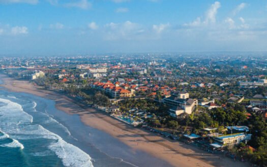
According to Liz Merry, rising tourist arrivals in Bali threaten to place an increased burden on the road network, particularly in Canggu and its surrounding area. Consequently, a water taxi service is being evaluated as an alternative connectivity option for tourism. However, she emphasized that the project plans are not yet finalized. At least 14 studies remain incomplete before any final decision on construction can be made.
“We are still in the early stages. 14 studies remain to be conducted, covering socio-cultural, environmental, and technical aspects. These will form the basis for determining the pier’s design and location,” said Liz.
The Berawa Beach area was considered in the preliminary study because its ocean wave characteristics are milder than at other points along the coast. This condition was a key technical factor in selecting the site.
However, technical aspects are not the only consideration. The presence of sacred areas and local customary activities around Perancak Beach necessitates a comprehensive review of the development plan.
Liz emphasized that the project should not be viewed solely in terms of physical infrastructure and transportation needs; the impact on the local community and the environment must also be carefully weighed.
“We want to improve the tourism experience and find solutions to traffic congestion. However, the development’s benefits must outweigh its impacts. Therefore, all community feedback will be included in the study,” she asserted.
The development’s impact on coastal conditions is also a concern. One specific issue is the breakwater’s potential to alter sedimentation patterns, which the preliminary study includes.
Regarding the planning phase, Udayana University has been conducting a feasibility study for over six months, starting last year. After the feasibility studies are completed, the process will then move to preparing the Detailed Engineering Design (DED). However, completing the studies and DED does not automatically mean construction can begin immediately.
“Several follow-up studies still need to be finalized, including socio-cultural and environmental assessments,” she said.
Budgeting is another factor; Liz noted that the funding source for the construction has not yet been finally confirmed. The project may require collaboration between the central government, the Badung Regency administration, the community, and the private sector. As a result, she could not yet confirm when pier construction would begin. “This is still the initial stage of communicating with the public. We do not want this plan to remain merely a concept. However, if the study results indicate it is not feasible, we must accept that. We must ensure the development does not cause more harm than good,” Liz emphasized.